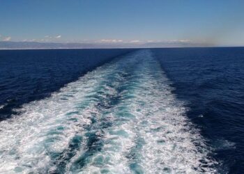
The Strait of Gibraltar, a critical maritime corridor linking the Atlantic Ocean and the Mediterranean Sea, is set to benefit from advanced satellite technology as the Centre national d’√©tudes spatiales (CNES) announces the launch of the SWOT mission. This innovative project aims to capture detailed measurements of ocean surface water levels, enabling unprecedented observation of waves and currents in the region. By delivering high-resolution data, SWOT is poised to enhance our understanding of marine dynamics in the Strait of Gibraltar, with implications for navigation, climate research, and environmental monitoring.
SWOT Satellite Unveils Detailed Ocean Wave Patterns in the Strait of Gibraltar
The Surface Water and Ocean Topography (SWOT) satellite has delivered unprecedented insights into the dynamic wave structures coursing through the Strait of Gibraltar. Through its advanced radar altimetry, SWOT meticulously maps the sea surface heights, capturing intricate wave patterns that were previously obscured by conventional observation methods. These detailed measurements illuminate how local wind conditions, tidal forces, and the constricted geography of the strait collectively sculpt a complex mosaic of ocean waves, providing crucial data for maritime navigation and climate research.
Among the key findings, SWOT identified several distinctive wave phenomena including:
- Kelvin waves: generated by the stratified water layers in the strait, influencing regional circulation.
- Internal solitons: large, non-linear waves traveling beneath the surface, impacting nutrient mixing.
- Surface gravity waves: shaped by fierce local winds and rapid tidal shifts.
| Wave Type | Characteristic | Impact |
|---|---|---|
| Kelvin Waves | Coastal trapped waves | Influence water circulation |
| Internal Solitons | Subsurface undulations | Enhance nutrient transport |
| Surface Gravity Waves | Wind-driven waves | Affect surface mixing |
Implications of Enhanced Wave Data for Navigational Safety and Marine Ecosystems
The integration of advanced wave monitoring systems like SWOT in the Strait of Gibraltar marks a significant leap forward for maritime navigation. Enhanced accuracy in wave height, direction, and frequency data empowers vessels to better anticipate hazardous sea conditions, reducing the risk of accidents and improving route efficiency. This is particularly critical in one of the world’s busiest and most strategically important waterways, where unpredictable wave patterns have historically posed challenges to shipping safety. Real-time data dissemination supported by SWOT technology enables port authorities and ship operators to make informed decisions promptly, minimizing delays and safeguarding human lives.
Beyond navigational benefits, this higher resolution of wave data holds profound implications for marine ecosystems. Understanding wave dynamics assists in assessing coastal erosion patterns and the health of vulnerable habitats such as seagrass beds and coral reefs. The ability to monitor subtle changes in wave energy helps scientists evaluate the impact of climate change on marine biodiversity. Key ecological benefits include:
- Improved habitat protection through predictive modeling
- Enhanced monitoring of sediment transport affecting spawning grounds
- Support for conservation strategies focusing on resilient marine species
| Parameter | Previous Methods | SWOT Capabilities |
|---|---|---|
| Wave Height Accuracy | ¬Ī30 cm | ¬Ī5 cm |
| Spatial Resolution | ~10 km | ~1 km |
| Temporal Frequency | Weekly | Daily |
Experts Recommend Leveraging SWOT Insights for Coastal Management and Climate Research
Utilizing SWOT’s advanced radar observations, scientists are unlocking new perspectives on the dynamic processes shaping coastal environments, particularly in the complex tidal systems of the Strait of Gibraltar. By providing high-resolution data on sea surface height and wave behavior, SWOT empowers researchers to track subtle changes in coastal circulation and energy dispersion. These insights are crucial for enhancing predictive models that inform climate resilience strategies and help safeguard vulnerable coastal ecosystems against rising sea levels and intensifying storm impacts. Real-time monitoring capabilities offered by SWOT are enhancing collaboration between oceanographers, climatologists, and local authorities, fostering proactive interventions tailored to regional needs.
- Improved coastal hazard assessments through precise wave height mapping
- Enhanced understanding of tidal mixing influencing nutrient transport and marine biodiversity
- Support for climate adaptation policies based on accurate coastal dynamics data
| SWOT Data Feature | Benefit for Coastal Management |
|---|---|
| Sea Surface Height | Tracks tidal currents and storm surges |
| Wave Spectrum Analysis | Identifies wave energy hotspots |
| Surface Wind Speed | Predicts erosion patterns |
In Conclusion
As the SWOT mission continues to monitor the dynamic wave patterns in the Strait of Gibraltar, the insights gained promise to enhance our understanding of oceanic processes and their broader climatic impacts. With CNES at the forefront of this innovative satellite endeavor, the data collected will not only inform maritime navigation and environmental management but also contribute to global efforts in climate monitoring. As these waves of information ripple across scientific communities, the Strait of Gibraltar emerges as a crucial natural laboratory, demonstrating the vital role of space technology in decoding Earth’s complex ocean systems.