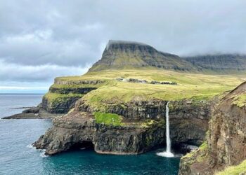


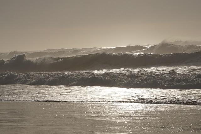
New research reveals how Atlantic winds play a crucial role in shaping sea-surface patterns around the Faroe Islands, offering fresh insights into regional ocean dynamics. Scientists analyzing satellite data and oceanographic measurements have identified distinct wind-driven influences on water circulation and surface temperature variations in this North Atlantic archipelago. These findings not only enhance understanding of local marine environments but also hold significance for climate monitoring and maritime activities in the surrounding waters.
Atlantic Winds Drive Distinct Sea Surface Patterns Surrounding the Faroe Islands
The dynamic interplay of northwesterly Atlantic winds and the rugged topography of the Faroe Islands creates striking and continually evolving sea surface patterns. These atmospheric forces drive complex oceanic currents and wave formations that influence local marine ecosystems and climate conditions. Satellite imagery captured over recent months reveals swirling eddies and filament-like structures, which play a crucial role in nutrient mixing and biological productivity in this remote North Atlantic region.
Researchers have identified key elements shaping these distinctive patterns:
- Wind speed and direction: Strong gusts generate surface turbulence, altering water temperature distribution.
- Sea surface temperature gradients: Variations amplify contrasts visible in thermal satellite images.
- Bathymetric features: Underwater ridges and fjords channel currents and amplify wave action.
| Factor | Effect on Sea Surface | Observed Outcome |
|---|---|---|
| Wind Speed | Increased turbulence | Formation of wave streaks and ripples |
| Bathymetry | Current deflection | Creation of coastal eddies |
| Temperature Gradient | Thermal contrast | Distinct color variations in satellite images |
Detailed Analysis Reveals Impact on Local Marine Ecosystems and Navigation
The intricate interplay between prevailing Atlantic winds and ocean currents around the Faroe Islands significantly shapes local marine ecosystems. Recent findings indicate that sustained wind patterns contribute to the formation of distinct sea-surface temperature gradients, which influence nutrient distribution and marine biodiversity. These gradients foster rich habitats for various plankton species, the foundation of the regional food web, ultimately supporting a thriving population of fish and marine mammals.
Furthermore, the altered sea-surface conditions present navigational challenges for vessels operating in these waters. Variations in wind-driven currents and wave heights have been linked to increased route adjustments and longer transit times. Key factors affecting maritime navigation include:
- Sudden changes in wave amplitude causing instability for smaller craft
- Localized eddies and current shifts increasing fuel consumption
- Visibility fluctuations due to surface turbulence
| Impact | Marine Ecosystem | Navigation |
|---|---|---|
| Temperature Variance | Enhances plankton growth | Requires route recalibration |
| Surface Currents | Alters fish migration | Increases fuel usage |
| Wave Patterns | Affects mammal habitats | Impacts vessel stability |
Experts Recommend Enhanced Monitoring to Support Sustainable Maritime Activities
The increasing complexity of maritime environments around the Faroe Islands demands a sophisticated approach to monitoring sea-surface dynamics influenced by Atlantic winds. Experts urge the integration of advanced satellite data and in-situ observations to precisely track changes in ocean currents, wave patterns, and related marine phenomena. Such enhanced surveillance is essential for mitigating risks posed to local fisheries, shipping routes, and coastal ecosystems, ensuring that human activities align with environmental sustainability goals.
Key elements of the recommended monitoring strategy include:
- Deployment of autonomous ocean sensors equipped with real-time data transmission capabilities
- Utilization of high-resolution satellite imagery and wind pattern analysis
- Implementation of interdisciplinary data-sharing platforms among governmental and scientific agencies
- Continuous assessment of wind-driven impacts on sea-surface temperature and salinity variations
| Monitoring Component | Purpose | Expected Outcome |
|---|---|---|
| Satellite Remote Sensing | Track wind patterns and sea-surface anomalies | Early warning for maritime operators |
| Autonomous Buoys | Collect in-situ oceanographic data | Improved fisheries management |
| Data Integration Platforms | Facilitate cross-sectoral analysis | Enhanced policy-making |
To Conclude
As research continues to unravel the intricate relationship between atmospheric forces and oceanic behavior, the latest findings on Atlantic winds shaping sea-surface patterns around the Faroe Islands offer valuable insights into regional climate dynamics. These developments not only enhance scientific understanding but also hold implications for local fisheries, navigation, and environmental monitoring. Staying attuned to such evolving phenomena will be crucial as communities and policymakers adapt to the changing marine environment in the North Atlantic.